Physical Geography
Geography
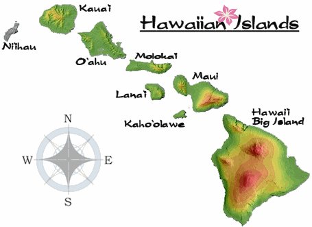
The Hawaiian islands, an island chain located at the northernmost tip of Polynesia, are the most isolated islands on Earth at 2,400 miles from the nearest continent. Oahu is the third largest island of the Hawaiian Islands. Oahu is at the same latitude as Hong Kong, Bombay and Yucatan Peninsula.
|
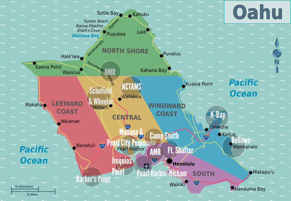
The map shows the five regions of Oahu: the North Shore, the Leeward Coast, Central Oahu, the Windward Coast, and the South (sometimes known as Honolulu).
|
Climate
|
Oahu is classified as tropical climate. Temperature does not fluctuate much between seasons, although winter is most prone to stormy weather. For Honolulu, average daily maximum and minimum temperatures are 84F and 70F respectively. The highest and lowest recorded temperatures are 94F and 53F respectively.
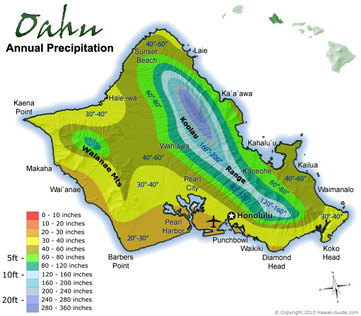
Oahu Rainfall is dependent on elevation. In the Honolulu coastal region, annual rainfall is 22 in/56cm, whereas in the city of Kailua it is 73in/193 cm a year and in the mountains rainfall can receive upwards of 200in/500 cm annually. Oahu experiences near constant trade winds throughout the year, which contribute to the cliff erosion that has developed on the windward areas of the major mountain ranges. The sea temperature for Honolulu has a max of 25.3C/77.6F and min of 24.2C/75.6F in May and varies little throughout the year. |
|
5 Regions of Oahu
|
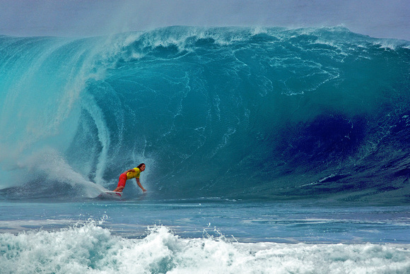
The North ShoreA one hour drive from Waikiki, the North Shore is a 7 mile stretch of beaches from Kaena Point to Kahana Bay that are known for having the biggest waves in the winter. Swells can be more than thirty feet! Because of this, beaches here host world surfing competitions.
Places to visit: Waimea Bay - a legendary surf spot where big wave surfing started in the 1950’s Haleiwa - a laid back surf town with great shopping |
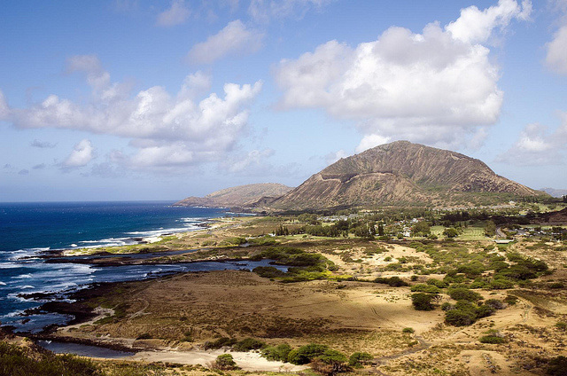
Leeward CoastThe Leeward coast is the drier stretch of rural towns to the west of the Waianae Mountains. The Waianae Mountains are a 22 mile long range formed primarily out of basaltic rock, and are the oldest area of volcanic activity. The range's valleys include the Nanakuli, Lualualei, Wainae and Makaha valleys. Although it has multiple peaks reaching over 3000 ft., Mount Kaala is the highest point in Oahu. There is also a swamp plateau within the range.
Places to visit: -Kaena Point - hike to the westernmost tip of Oahu -Aulani Disney Resort & Spa |
|
|
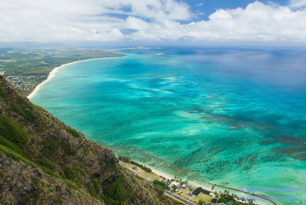
Windward CoastThe Windward coast is on the east side of the island and gets the most rain. This area of beautiful lush beaches is bound by the Koolau Range. These mountains were created by volcanic eruptions that also created the Diamond Head and Koko Head capes.
Places to visit: -Valley of the Temples - a replica of a Japanese Buddhist temple -Ko Olina Lagoons - 4 man made lagoons that are protected for swimming and snorkeling -Makapuu Point Lighthouse - a lighthouse at the easternmost tip of Oahu |
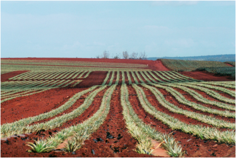
Central OahuCentral Oahu is a fertile valley east of Waikiki of pineapple plantations and residential areas. This is the area between the Waianae Mountains and the Koolau Range.
Places to visit: - Dole Plantation and the pineapple shrub maze -Pearl Harbor- final resting place of the USS Arizona |
|
|
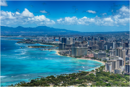
Honolulu (South Oahu)Honolulu, the capital of Hawaii, means "sheltered bay." Honolulu faces south and stretches from Pearl Harbor to Waikiki Beach, one of the most popular vacation destinations in the world. This is the most developed part of the island with lots of hotels, shopping, and resorts.
Places to visit: Waikiki Beach - a 2 mile stretch of white sand beaches Hanauma Bay - a great place to snorkel Iolani Palace - the only residence of royalty in the United States |
|
Sources:
-Oahu Geography Research http://www.hawaii-guide.com/oahu/regions -http://www.gohawaii.com/en/oahu/regions-neighborhoods/ -Glenda Bendure & Ned Friary, Oahu, Lonely Planet Pub: 2003, 13-20. -Oahu Geography Map http://hsh.hawaiimilitarywives.com/wp-content/uploads/2014/04/Map_of_Oahu1.jpg -North shore photo: http://www.thesmokingcamera.com/img/s2/v1/p98390356-3.jpg |
-Leeward coast photo: http://www.migratorynerd.com/wordpress/wp-content/uploads/2011/07/5953160402_50fff2e6c5_z-1.jpg
-Windward coast photo: http://cdn.c.photoshelter.com/img-get2/I0000lbuLs7ZoQ6I/fit=1000x750/Windward-coast-of-Oahu-from-Makapuu-cliffs-Koolau-Mountains-Oahu-Hawaii-OB-0315-MarkAJohnson.jpg -Central Oahu photo: http://www.portaloha.com/SecretsOfHawaii/images/PineappleField.jpg -Honolulu photo: http://iscreamsundae.com/wp-content/uploads/2015/05/Best-beaches-in-USA-Honolulu-Oahu.jpg -Precipitation Map http://www.hawaii-guide.com/images/body_images/oahu_precipitation.jpg |
